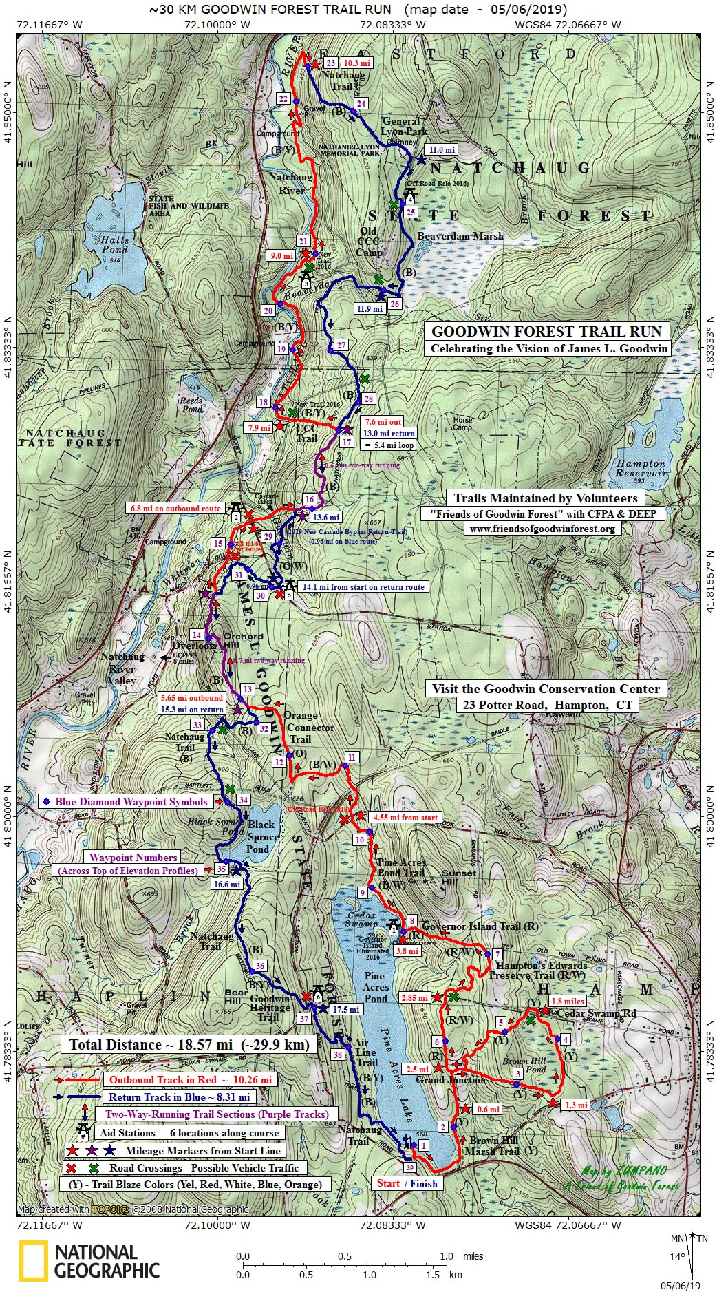
30K Course: Run to General Lyons Memorial Park and Back: The 30K course follows the same route as the 10K course to the Governor’s Island Aid Station:
10K Course - “Race to Governor’s Island and Back:” This ~5.8-mile course utilizes the Yellow blazed trail around Brown Hill Marsh, and sections of the Red, Red/White, and Blue/White blazed trails. Runners can expect an abundance of rocks and roots; rolling terrain. One Aid Station is located at Governor’s Island, 3.4 miles.
The course then heads north and follows the Pine Acres Pond shoreline (Blue/White blazed trail), crossing Estabrooks Road, intersecting with the Orange Connector trail and continues north to meet the Natchaug Trail (Blue blazed) at 5.7 miles. The course then follows the Natchaug Trail north crossing Morey Road (Aid Station 2) at 6.8 miles. After another 1.5 miles on the Natchaug Trail and up the Goodwin Cascade the route descends on the CCC Trail (B/Y blazed) to parallel the Natchaug River and passes Aid Station 3 at 9 miles. It continues north along the River on the B/Y to climb up to the Natchaug Trail at 10 miles. It proceeds south on the blue blazed Natchaug Trail to the Nathaniel Lyons Memorial State Park and crosses Kingsbury Road at 11.4 miles (Aid Station 4). The course continues south on the Natchaug Trail again crossing Kingsbury Road and a forest road. At the top of the Goodwin Cascade (13.6 miles) the course bears to the left on the Orange/White blazed trail. After crossing Station Road (Aid Station 5) follow the Orange Trail to the short Connector Trail back to the Natchaug Trail. The course continues over Orchard Hill, skirting the western side of Black Spruce Pond, and ascending Bear Hill before dropping down the Goodwin Heritage Trail (Blue/Yellow blazed), and crossing Eleventh Section Road (Aid Station 6) and joining the Airline Rail Trail. The Natchaug Trail picks up to left off the Airline Trail and continues to the finish.
Course is a combination of single track and forest roads. Runners can expect significant stretches of technical footing, and generally rolling terrain with short steeper ascents and descents.
Runners will find the course well marked with signs, surveyor tape and flags.
Aid Stations: There will be 7 aid stations along the course at miles 3.5, 4.5, 7.0, 9.0, 11.5, 14.1, and 17.5.
TIME LIMIT:
Runners are required to maintain a pace of 18 min/mile. Cut-off times are set at the Aid Stations located at 11 miles and again at 14 miles
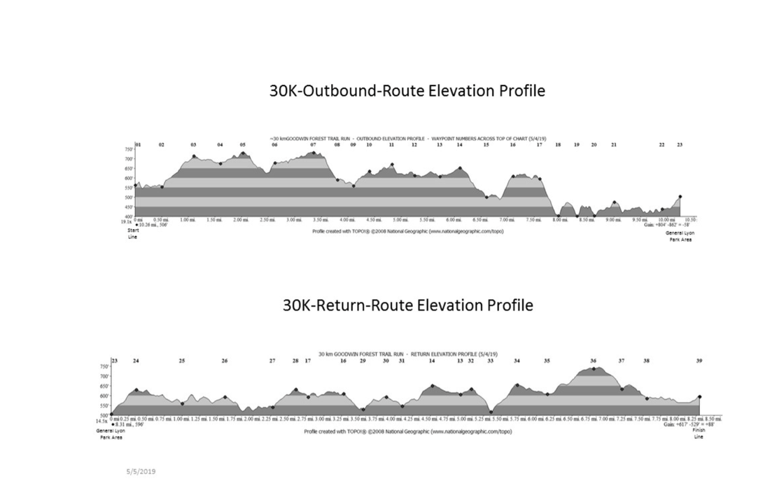
30K Course Map and Elevation Profiles: 30K Route, Elevation Profile Outbound, Elevation Profile Return
((clicking on image will open in a new window to allow you to print out)


